If you would like to get in touch, please feel free to contact: email hidden; JavaScript is required
Browse collection
- Full collection
- 18th Century & earlier
- Ackermann
- Africa
- Alken
- Animals
- Arabasia
- Architecture/Mansions
- Art
- Australasia
- Botany
- British Isles
- Caricatures
- Children
- China
- Chromo added colour
- Chromolithographs
- Conchology
- Costume
- Cruikshank
- Culture/Lifestyle
- Dutch
- East European
- Far East
- France
- Furniture/Antiques
- General
- Germany
- Grandville
- Heraldry
- History
- History - England
- History - Europe
- Holy Land
- India
- India - sepia
- Islam
- Italy
- Japan
- Literature
- London
- Manuscript
- Map
- Military
- Monnier
- Natural history
- Pastimes
- Pochoir
- Polar regions
- Portraits
- Religious/Christian
- Religious/other
- Rowlandson
- Russia
- Science
- Scrapbook
- Sepia
- South America
- Sports/Hunting
- Stamps
- Swiss
- The Americas
- Theatre
- Travel/Scenery
- Watercolours
- World
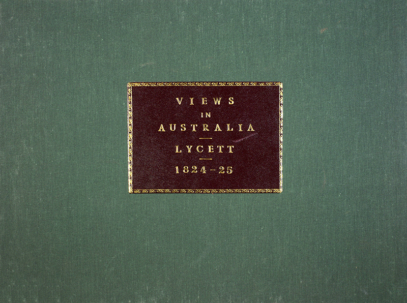
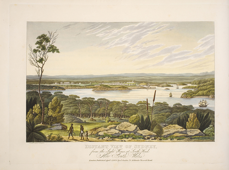
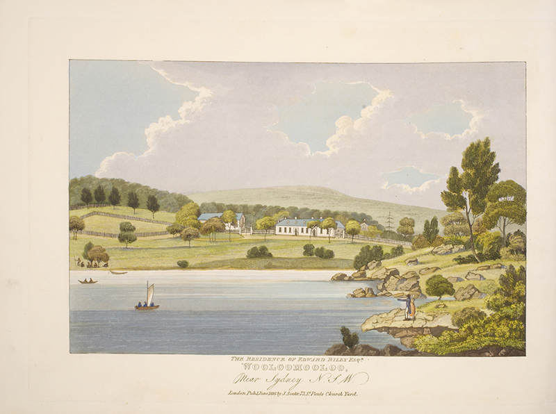
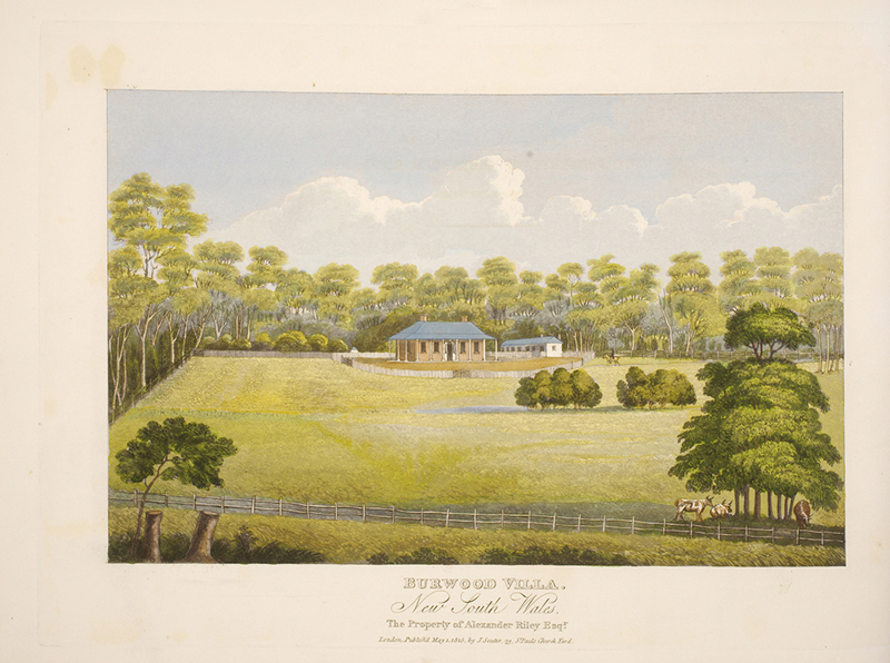
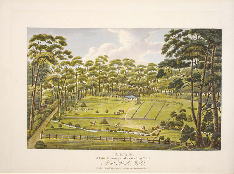
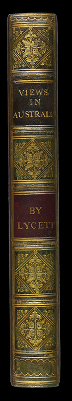
LYCETT, J.
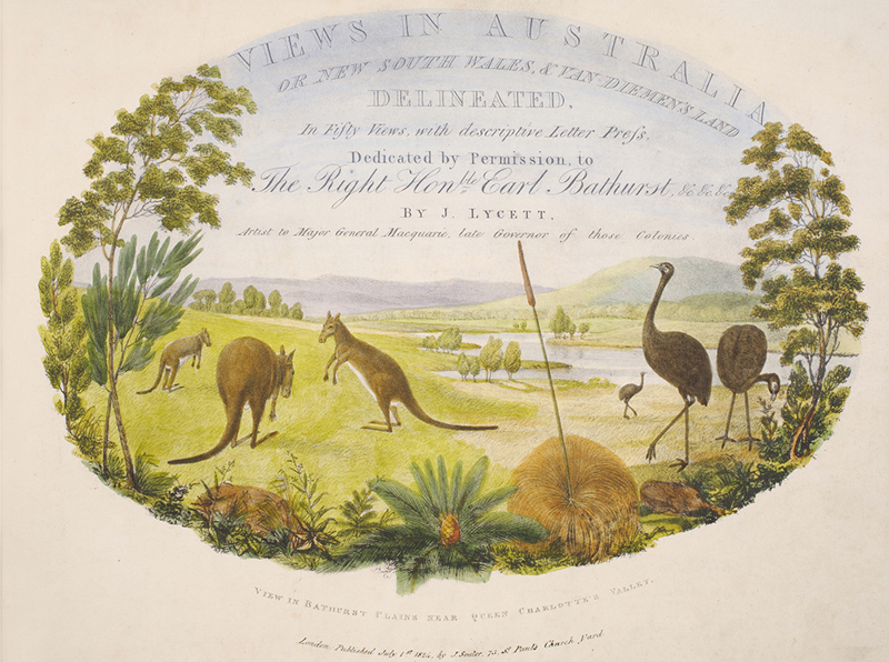
Views in Australia or New South Wales & Van Diemen's Land delineated...
'THE MOST CELEBRATED OF AUSTRALIAN TOPOGRAPHICAL PLATE BOOKS' (Wantrup). These famous views were first produced in 13 monthly parts, July 1824 to June 1825; 24 plates are of New South Wales and an equal number of Van Diemen's Land. A feat of exploration as well as art which led Wantrup to call Lycett 'the outstanding artist of his period in Australia.'


- Published
- London: J. Souter, 1824-25.
- References
- Abbey Travel II 570; Tooley 310; Ferguson nos 974 (parts) & 1031 (volume); Bobins 328.
- Plates
- 49
- Binding/Size
- M=4to
- Value
- 25001-100000
- Published
- London: J. Souter, 1824-25.
- Ref
- 5548
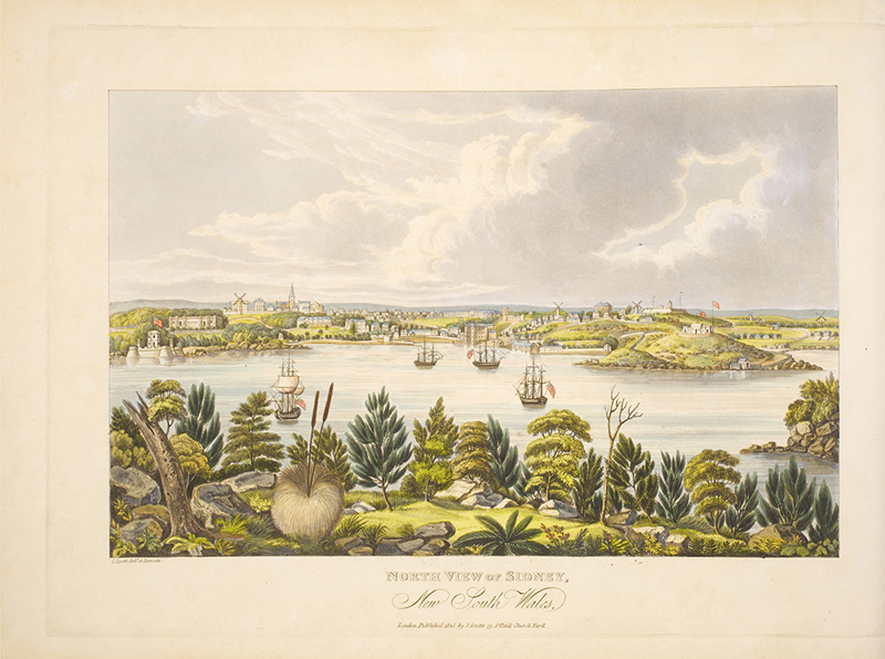
Oblong folio, dedication, advertisement, descriptive text, one leaf per plate. Forty-nine hand-coloured aquatint plates, except the title, which is a coloured lithograph, two uncoloured maps of New South Wales (N.S.W.), and Van Dieman's Land (Tasmania). Half green calf over original marbled boards, decorative gilt to spine, marbled endpapers, housed in a green linen-covered box with gilt and morocco title label to cover and spine. The advertisement says a twelfth part was to contain a brief history of Australia never seems to have been published, nor was a mentioned Natural History of Australia. Coloured plates in order: New South Wales. 1. Title page. View in Bathurst near Queen Charlotte's Valley. 2. North view of Sydney, the Capitol. 3. A distant view of Sydney, from the lighthouse, South head. 4. View of Wooloomooloo, near Sydney. 5. View of Burwood, the property of A. Riley, Esq. 6. View of Capt. Piper's Naval Villa, at Eliza Point, near Sydney. 7. View of Raby, the property of A. Riley, Esq. 8. View of Kissing Point. 9. View of the Heads, at the entrance to Port Jackson. 10. View of Botany Bay. 11. View of Paramatta. 12. View of the Female Orphan School, near Paramatta. 13. View of the Residence of John McArthur, Esq. near Paramatta. 14. View of Liverpool. 15. View of Windsor, upon the River Hawkesbury. 16. View of Wilberforce, on the Banks of the River Hawkesbury. 17. View upon the Nepean River, at the Cow-Pastures. 18. View on the Wingee-Carrabee River. 19. View of Lake George. 20. View of Newcastle. 21. View of the Sugar-loaf Mountain, near Newcastle. 22. View of Lake Patterson. 23. View of Port Macquarie, at the entrance of the River Hastings. 24. View of Becket's Fall, on the River Apsley. 25. View of Bathurst Cataract, on the River Apsley. Van Dieman's Land. 26. Near view of Hobart Town. 27. A distant view of Hobart Town. 28. View of Roseneath Ferry, near Hobart Town. 29. View of Roseneath Ferry, taken from the east side. 30. View of the Governor's Retreat at New Norfolk. 31. View of Mount Wellington, near Hobart Town. 32. View of Mount Direction, near Hobart Town. 33. View of Mount Dromedary, on the River Derwent. 34. View of Mount Nelson, near Hobart Town, from Mulgrave Battery. 35. View from the Top of Mount Nelson, with Hobart Town and circumjacent Country. 36. Scene up the River Huon. 37. View of Ram-head Point, Port Davey. 38. View of Cape Pillar, near the entrance to the River Derwent. 39. View from near the top of Constitution Hill. 40. View of the South End of Schouten's Island. 41. View of Table Mountain, part of the Jordan, River Derwent. 42. View of Beaumont's Lake. 43. View of Salt-Pan Plain. 44. View of Western Boundary Lake. 45. View on the Macquarie River, near the Ford at Argyle Plains. 46. View upon the South Esk River. 47. View of Tasman's Peak and Macquarie's Plains. 48. View of Ben Lomond. 49. View on the River Tamar and part of the Asbeston Hills.