If you would like to get in touch, please feel free to contact: email hidden; JavaScript is required
Browse collection
- Full collection
- 18th Century & earlier
- Ackermann
- Africa
- Alken
- Animals
- Arabasia
- Architecture/Mansions
- Art
- Australasia
- Botany
- British Isles
- Caricatures
- Children
- China
- Chromo added colour
- Chromolithographs
- Conchology
- Costume
- Cruikshank
- Culture/Lifestyle
- Dutch
- East European
- Far East
- France
- Furniture/Antiques
- General
- Germany
- Grandville
- Heraldry
- History
- History - England
- History - Europe
- Holy Land
- India
- India - sepia
- Islam
- Italy
- Japan
- Literature
- London
- Manuscript
- Map
- Military
- Monnier
- Natural history
- Pastimes
- Pochoir
- Polar regions
- Portraits
- Religious/Christian
- Religious/other
- Rowlandson
- Russia
- Science
- Scrapbook
- Sepia
- South America
- Sports/Hunting
- Stamps
- Swiss
- The Americas
- Theatre
- Travel/Scenery
- Watercolours
- World
MASLEN, T.J.
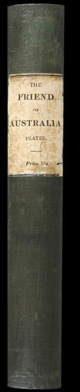
The Friend of Australia.
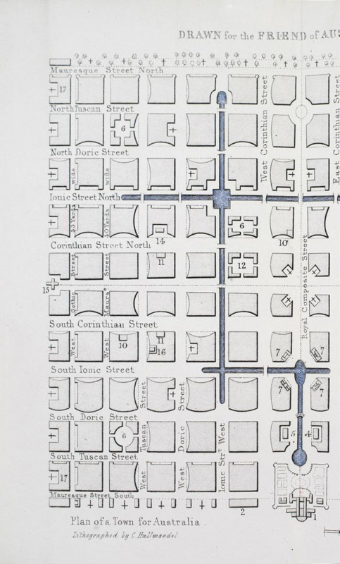
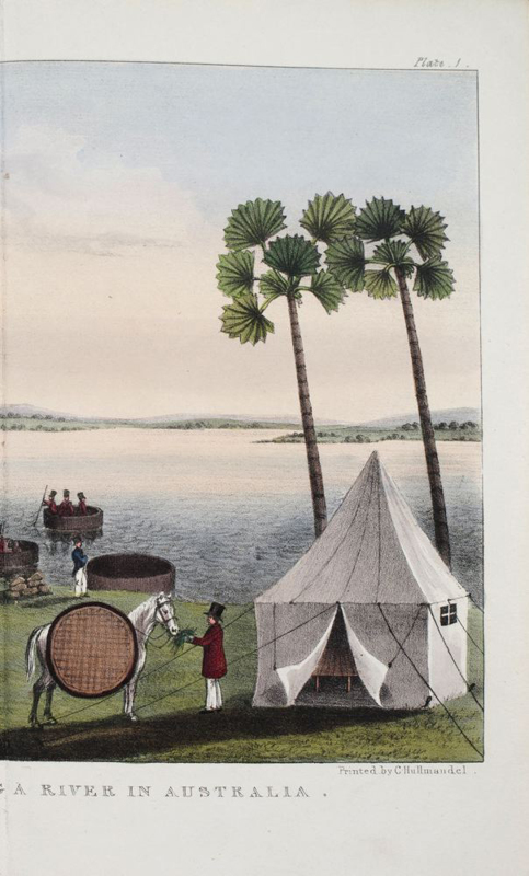
'The supreme monument to the speculative geography of the 1820s and 1830s . . . His eccentric plan for the survey of the interior is a monument to the fascination exerted by the vast unknown interior on contemporary Europeans. He offers detailed and elaborate advice on the preparation and conduct of his proposed expedition, suggesting the importation of elephants and camels, the construction of special craft to navigate the inland sea, and so on. As well, he devotes attention to other matters relating to the future of society in Australia. Everything from the planning of towns to the establishment of a bunyip aristocracy has a place on his broad canvas' [Wantrup, pages 192-3]. The map is an imaginative depiction of the Australian continent, including a large inland sea and 'the supposed entrance of 'The Great River'. The plates show scenes from Maslen's proposed exploring expedition, a plan for a township, and a design for an Australian flag.


- Published
- London: Hurst, Chance & Co., 1830.
- References
- Abbey Travel II 574; Ferguson I, 1379; Wantrup, pp.192-93; Bobins supplementary list 08 /14.
- Plates
- 5
- Binding/Size
- S=8vo
- Value
- 0-5000
- Published
- London: Hurst, Chance & Co., 1830.
- Ref
- 5184
Octavo (9 x 6 inches), original green cloth with binder's ticket, paper label to spine. Five hand-coloured lithographic plates, four are folding, plus a folding map. Coloured plates in order: 1. Plan of a Town for Australia (folding.) 2. Australian Flag. 3. The Expedition Crossing a River in Australia. 4. Carrying large Canoes with the Expedition in Australia. 5. The Expedition in a Desert in Australia.