If you would like to get in touch, please feel free to contact: email hidden; JavaScript is required
Browse collection
- Full collection
- 18th Century & earlier
- Ackermann
- Africa
- Alken
- Animals
- Arabasia
- Architecture/Mansions
- Art
- Australasia
- Botany
- British Isles
- Caricatures
- Children
- China
- Chromo added colour
- Chromolithographs
- Conchology
- Costume
- Cruikshank
- Culture/Lifestyle
- Dutch
- East European
- Far East
- France
- Furniture/Antiques
- General
- Germany
- Grandville
- Heraldry
- History
- History - England
- History - Europe
- Holy Land
- India
- India - sepia
- Islam
- Italy
- Japan
- Literature
- London
- Manuscript
- Map
- Military
- Monnier
- Natural history
- Pastimes
- Pochoir
- Polar regions
- Portraits
- Religious/Christian
- Religious/other
- Rowlandson
- Russia
- Science
- Scrapbook
- Sepia
- South America
- Sports/Hunting
- Stamps
- Swiss
- The Americas
- Theatre
- Travel/Scenery
- Watercolours
- World
[JOHNSON, J.]
An Historical and Descriptive Account of Antigua...


- Published
- London: Henry Baylis for the author, 1830.
- References
- This work is not in Abbey?? (678), or Tooley. Bobins 14.
- Plates
- 7 + 3
- Binding/Size
- L=FOLIO
- Value
- 25001-100000
- Published
- London: Henry Baylis for the author, 1830.
- Ref
- 5605
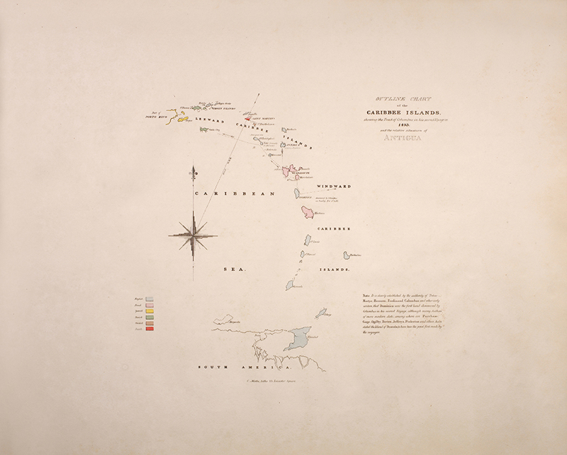
Oblong folio, errata slip, advertisement slip, half-title, hand-coloured linen-backed map, seven fine hand-coloured aquatint plates. Half straight-grained wine morocco blind-stamped and gilt-ruled, decorative purple morocco title label laid down on upper board, gilt to spine, new endpapers. A RARE WORK. The author planned to publish an extensive series of views of the West Indies, with each part containing images and descriptions of the islands. The plan seems to have been abandoned after three parts because objections were made to the form in which these W.I. views were published. Apparently, purchasers wanted to be able to buy individual islands. There was obviously difficulty in obtaining subscribers. A depressed Johnson wrote that so few people had come forward that he was unsure if it was worth printing the list of subscribers. Coloured plates in order: 1. [Map] A New and Improved map of the Island of Antigua in the West Indies (folding). 2. [Map] Outline Chart of the Caribbee Islands... 3. [Map] A Geological map of Antigua. 4. Saint John's, Antigua, from Otto's. 5. Saint John's Harbour, Antigua, from the Southward and Eastward. 6. View near Saint John's, Antigua, from Gamble's. 7. View of Saint John's Harbour, Antigua, from Friar's Hill. 8. View in Old North Sound, Antigua, from Mount Joy. 9. View in Old North Sound, Antigua, from Freemans. 10. English Harbour, Antigua, from Great George Fort, Monks Hill.