If you would like to get in touch, please feel free to contact: email hidden; JavaScript is required
Browse collection
- Full collection
- 18th Century & earlier
- Ackermann
- Africa
- Alken
- Animals
- Arabasia
- Architecture/Mansions
- Art
- Australasia
- Botany
- British Isles
- Caricatures
- Children
- China
- Chromo added colour
- Chromolithographs
- Conchology
- Costume
- Cruikshank
- Culture/Lifestyle
- Dutch
- East European
- Far East
- France
- Furniture/Antiques
- General
- Germany
- Grandville
- Heraldry
- History
- History - England
- History - Europe
- Holy Land
- India
- India - sepia
- Islam
- Italy
- Japan
- Literature
- London
- Manuscript
- Map
- Military
- Monnier
- Natural history
- Pastimes
- Pochoir
- Polar regions
- Portraits
- Religious/Christian
- Religious/other
- Rowlandson
- Russia
- Science
- Scrapbook
- Sepia
- South America
- Sports/Hunting
- Stamps
- Swiss
- The Americas
- Theatre
- Travel/Scenery
- Watercolours
- World
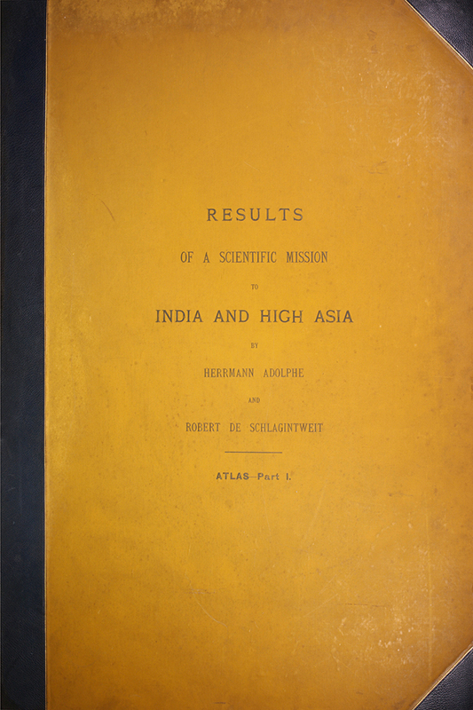
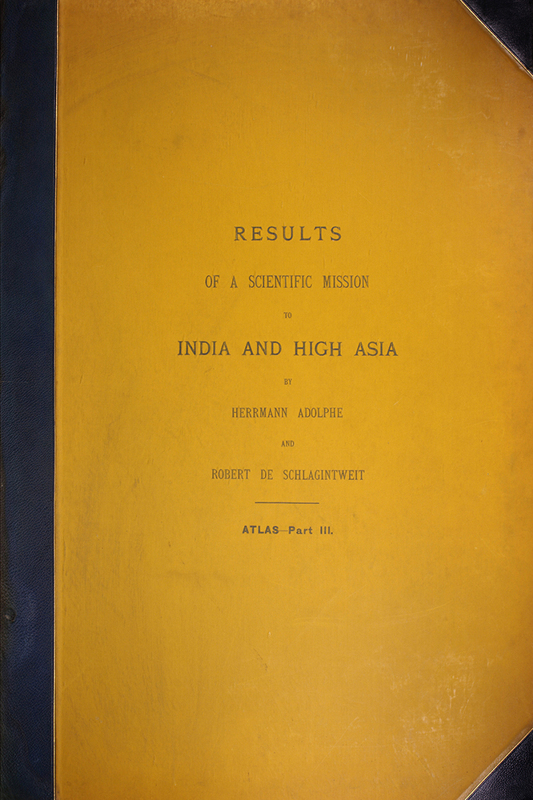
SCHLAGINTWEIT, Robert.
Adolphe and Herman.
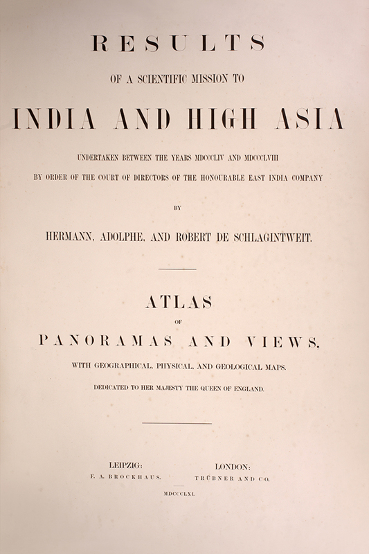
Scientific Mission to India and High Asia undertaken between the years 1854 and 1858 by order of the Court of Directors of the Hon. East India Company.
The brothers were Alpine glaciologists from Germany who were invited by the East India Company in 1854 to complete the Magnetic Survey of the Indian subcontinent on the recommendation of Alexander von Humboldt.


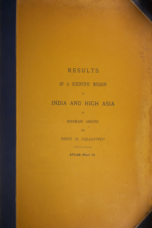


- Published
- Leipzig and London: Brockhaus and Trubner & Co., 1861-66.
- References
- Bobins 1122; Yakushi S65 (4).
- Plates
- 40
- Binding/Size
- XL=elephant folio
- Value
- 25001-100000
- Published
- Leipzig and London: Brockhaus and Trubner & Co., 1861-66.
- Ref
- 5279
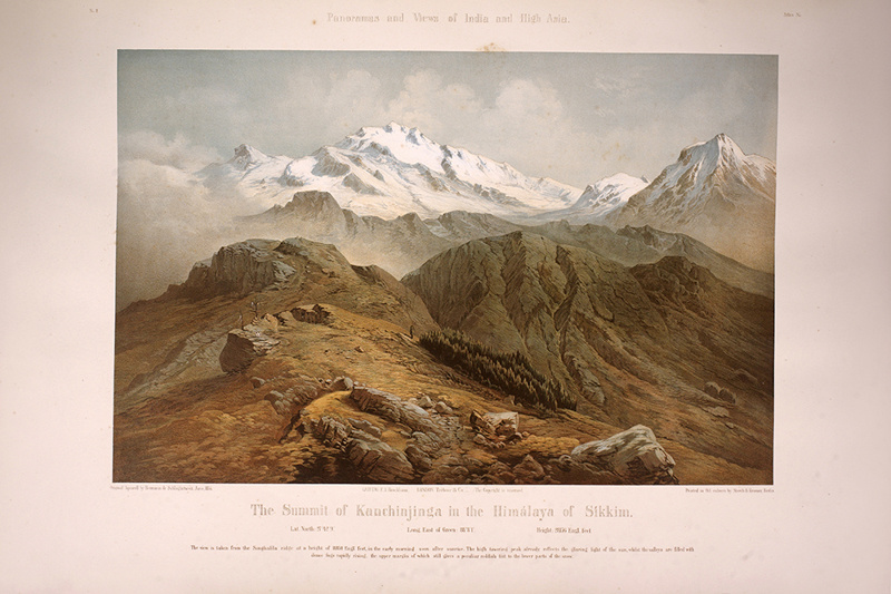
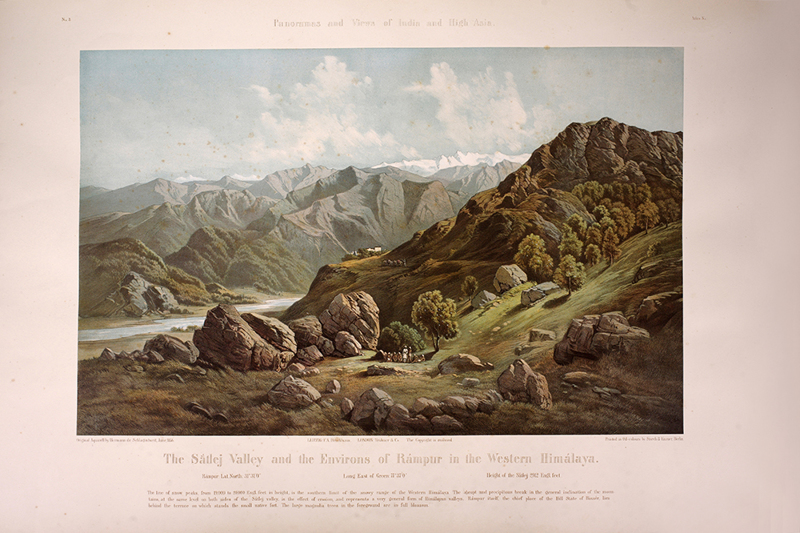
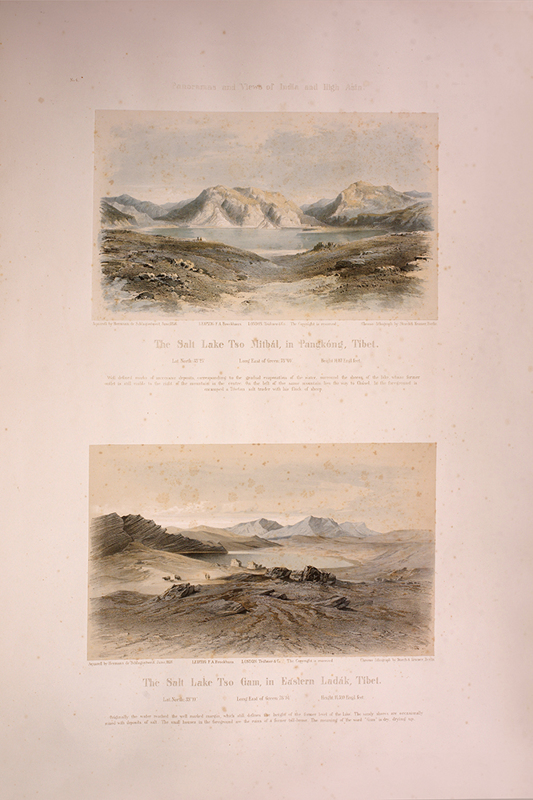
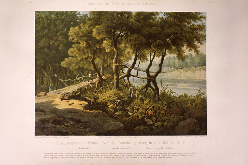
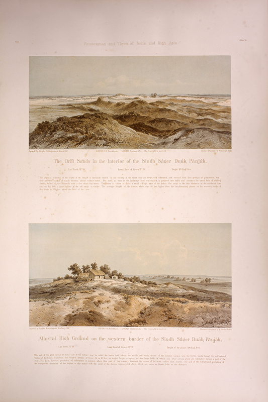
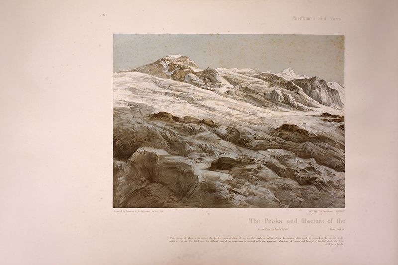
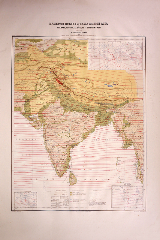
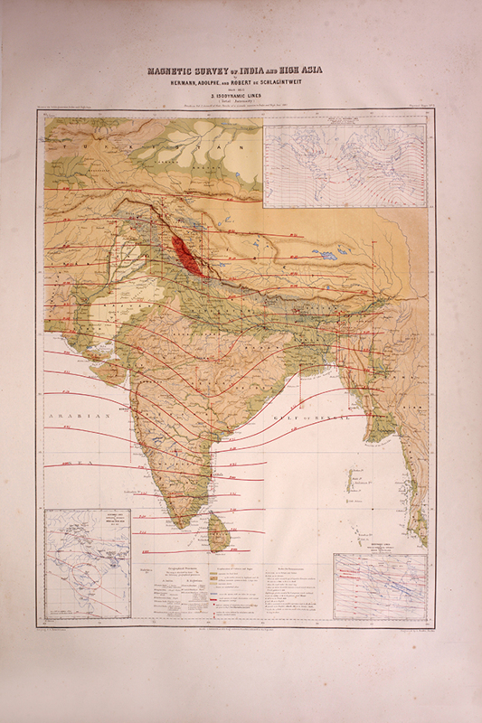
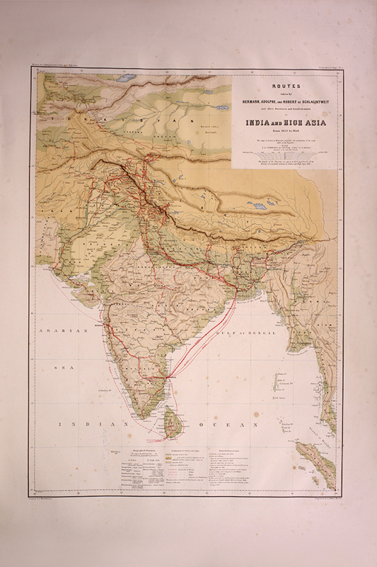
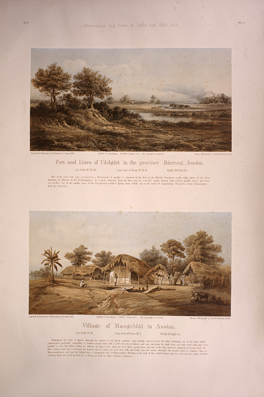
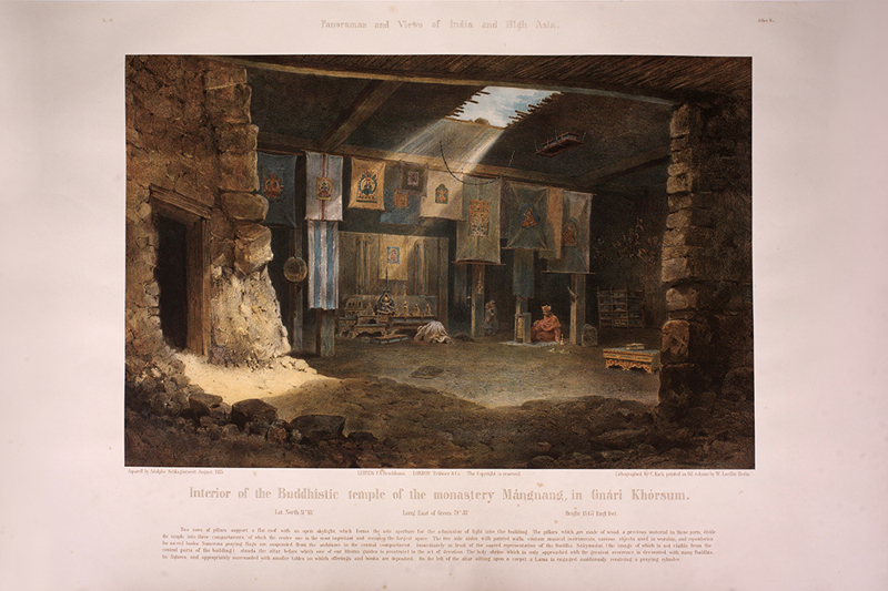
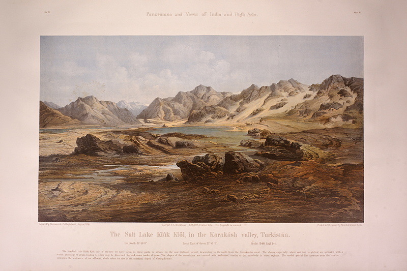
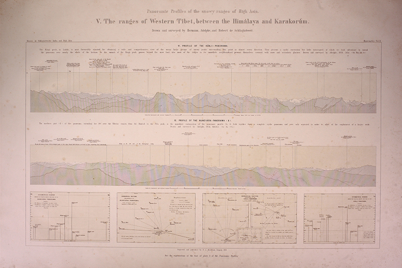
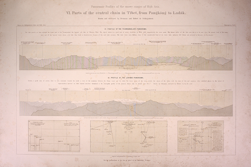
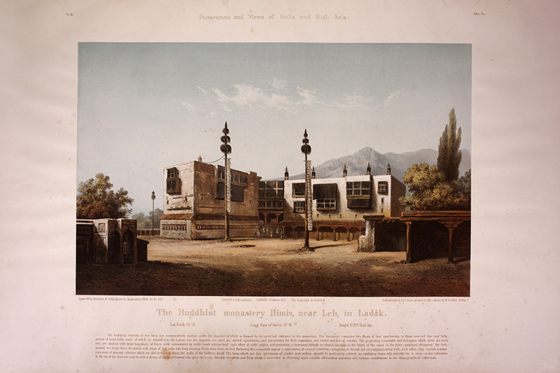
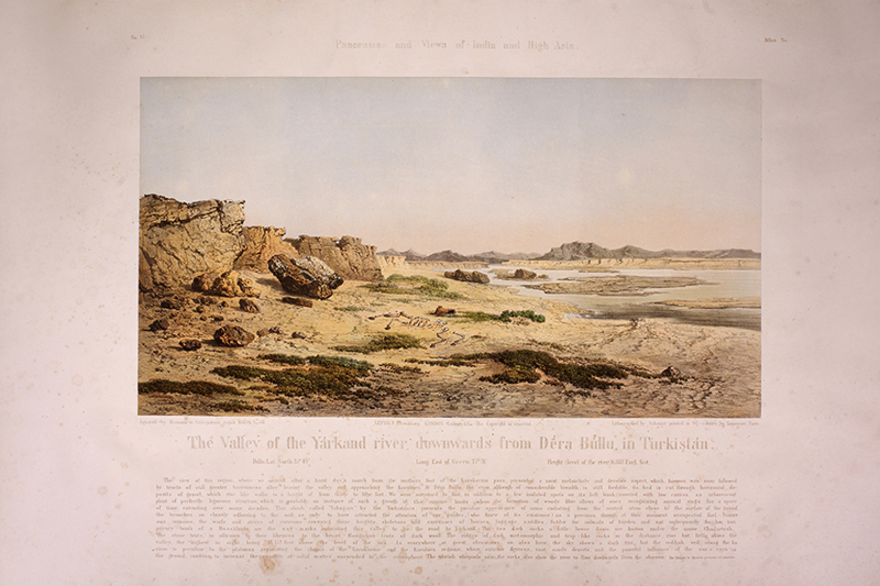
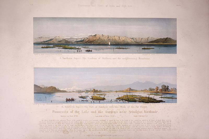
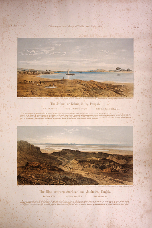
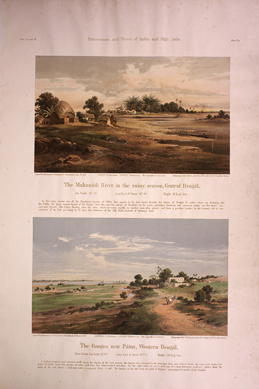
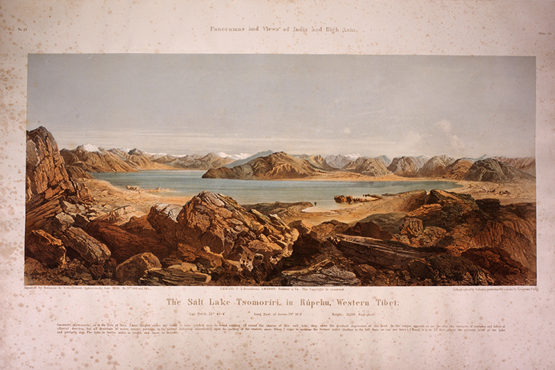
Elephant folio, 4 x 4to text volumes and 4 large atlas volume, in four original parts, printed title, dedication, 9 lithographed maps, 7 in colour, metrological chart, 7 profiles, and 29 plates, plate 7 on two sheets, plates 4, 6ll. and 18 with two illustrations, plates 21-23 on three sheets, all coloured lithographed plates. One of the finest examples of topographical views in 19th-century colour lithography, printed by Storch & Kramer and W. Loeillet in Berlin and Lemercier in Paris. Lithographed by Koch in Berlin and Sabatier in Paris, after watercolours by Hermann de Schlagintweit. Plates include spectacular views of snow-covered Mount Everest. Coloured plates in order: Panoramas and Views of India and High Asia. Atlas volume 1. 1. Gaurisankar, or Mount Everest, in the Himalaya of Nepal. 2. The Summit of Kanchinjinga in the Himalaya of Sikkim. 3. The Satlej and the Environs of Rampur in the Western Himalaya. 4. The Salt Lake Tso Mitbal, in Pangkong, Tibet. / The Salt Lake Tso Gam, in Eastern Ladak, Tibet. 5. Cane Suspension Bridge over the Temshang river in the Khassia Hills. 6. The Drift Sands in the Interior of the Sindh Sager Duab, Panjab / Alluvial High Ground on the western border of the Sindh Sager Duab, Panjab. 7. The Peaks and Glaciers of the Sasser Pass in Nubra, Tibet. (panorama) 8. The Kunda Range, in the Nilgiris, southern India. 9. Leh, the capital of Ladak, In Western Thibet. 10. The Chorkonda Glacier in Balti, Tibet. Atlas volume 2. Magnetic Survey of India and High Asia. 11. [Map] Isogonic Lines (Declination). 12. [Map] Isoclinal Lines (Dip). 13. [Map] Isodynamic Lines (Total Intensity). 14. [Map] Routes taken by Hermann, Adolphe, and Robert de Schlangintweit from 1854-58. 15. Fort and Lines of Udelguri in the province Darrang, Assam / Village of Mangledai in Assam. 16. Interior of Buddhistic temple of the monastery Mangnang, in Gnari Khorsum. 17. The Salt Lake Kiuk Kiol, in the Karakash valley, Turkistan. 18. The flats of the Hiron valley from the Barer plateau near Kattingi, Central India. 19. Palm grove and Singhalese habitations near Galle, Ceylon. Panoramic profiles of the snowy ranges of High Asia. 20. The Himalaya of Bhutan, Sikkim, and Nepal. 21. The Himalaya of Kaman and Garhval. 22. The western chains of the Himalaya from Simla to Kashmir. Atlas volume 3. Panoramic profiles of the snowy ranges of High Asia. 23. The Northern slopes of the Himalaya and the Trans-Satlej range in Central Tibet. 24. The ranges of Western Tibet, between the Himalaya and Karakoram. 25. Parts of the Central chain in Tibet, from Pangkong to Ladak. 26. The Karakorum, with the plateau in Turkistan, and the Kuenluen. Panoramas and Views of India and High Asia. 27. The Buddhist monastery Himis, near Leh, in Ladak. 28. The Valley of the Yarkand river, downwards from Dera Bullu, in Turkistan. 29. Northern Aspect: The Gardens of Shalimar, and the neighbouring Mountains / Southern Aspect: The Fort of Srinagar with the Chain of the Pir Panjal. (panorama) 30. The Summit of Parisnath, in Bahar. 31. Central Assam and the Brahmaputra jungle, from Ogri Hill near Tezpur. Atlas volume 4. Illustrations of the Meteorology of India and High Asia. 32. [Maps] Temperature of the Air [and] the Isothermal Lines of the Year (Sea-Level) for India and the Archipelago... 33. [Maps] Temperature of the Air [and] the Isothermal Lines of the Seasons... 34. [Maps] Temperature of the Air [and] Stations and Isothermal profiles of High Asia... Panoramas and Views of India and High Asia. 35. Alluvial Deposits in the Brahmaputra, above Rakusni Hill, Assam / The Jhils of Bengal, at high water. 36. The Jhilum, or Behut, in the Panjab / The Bias between Amritsar and Jalander, Panjab. 37. The Mahanadi River in the rainy season, Central Bengal / The Ganges near Patna, Western Bengal. 38. The Salt Lake Tsomoriri, in Rupchu, Western Tibet. 39. The Salt Lake Tsomognalari, in Pangkong, Western Tibet. 40. The Chain of the Kuenluen, from Sumgal, In Turkistan.